Program Overview
NRRI’s Interactive Tools for Decision Support program creates specialized, web-based software programs that provide decision support for natural resource use and management. Our complimentary graphic design and web development capabilities allow us to create custom data analysis and information delivery tools.
Program Goal
Develop customized software applications and websites that allow our partners to efficiently understand data, share information, and make better decisions.
Program Impact, unique strength
NRRI is a leader in the development of interactive mapping applications that provide decision support to various natural resource issues. For more than two decades, we have been on the forefront of data visualization and information delivery in the natural resources field through custom application development.
Recent Projects
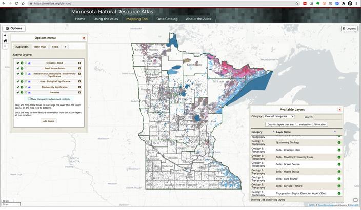
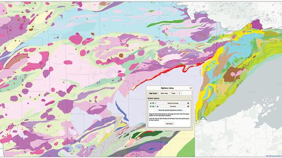
- Minnesota Natural Resource Atlas
- Minnesota Restorable Wetland Prioritization Tool
- Forest Optimization Tool
- Great Lakes Stressors
Staff


Featured Research Projects


Related News

State funds development of a GIS tool that puts 400 layers of information at finger tips for better planning, management
Media Coverage
- – MNAtlas.org wins University of MN Innovation Impact Award – Duluth News Tribune