Lab Overview
NRRI’s Geographic Information Systems (GIS) laboratory was established in 1988 through a National Science Foundation grant, with matching funds from the University of Minnesota. Using state-of-the-art GIS software and hardware, the lab provides NRRI, other university researchers, and external partners with access to advanced GIS methods for basic and applied natural resources research. These capabilities are enhanced through access to the resources of the Minnesota Supercomputing Institute.
The lab’s capabilities extend beyond GIS to include the design and development of databases and custom web applications for visualizing and analyzing data. Additionally, the lab can provide remote sensing and image classification with it’s fixed wing unmanned aerial vehicle (UAV). This broad set of capabilities and experience allows the lab to augment the spatial data and information needs of Minnesota.
Capabilities, Expertise, Services, Equipment
- Creation, processing, analysis, modeling, and mapping of spatial data
- Working with large data sets
- Lidar processing and analysis of terrain and vegetation canopies
- Custom web mapping application development
- ArcGIS Online map creation
- Database development
- Remote sensing with WingtraOne Gen II mapping and surveying UAV with vertical take off and landing capabilities.
Research Projects and Resources
Research Projects

The ForCAST tool attempts to provide forestry professionals and land managers with an opportunity to evaluate how a changing climate and changing markets might affect Minnesota’s forests and
Online mapping tools and data for natural resource planning, management, and research in Minnesota.

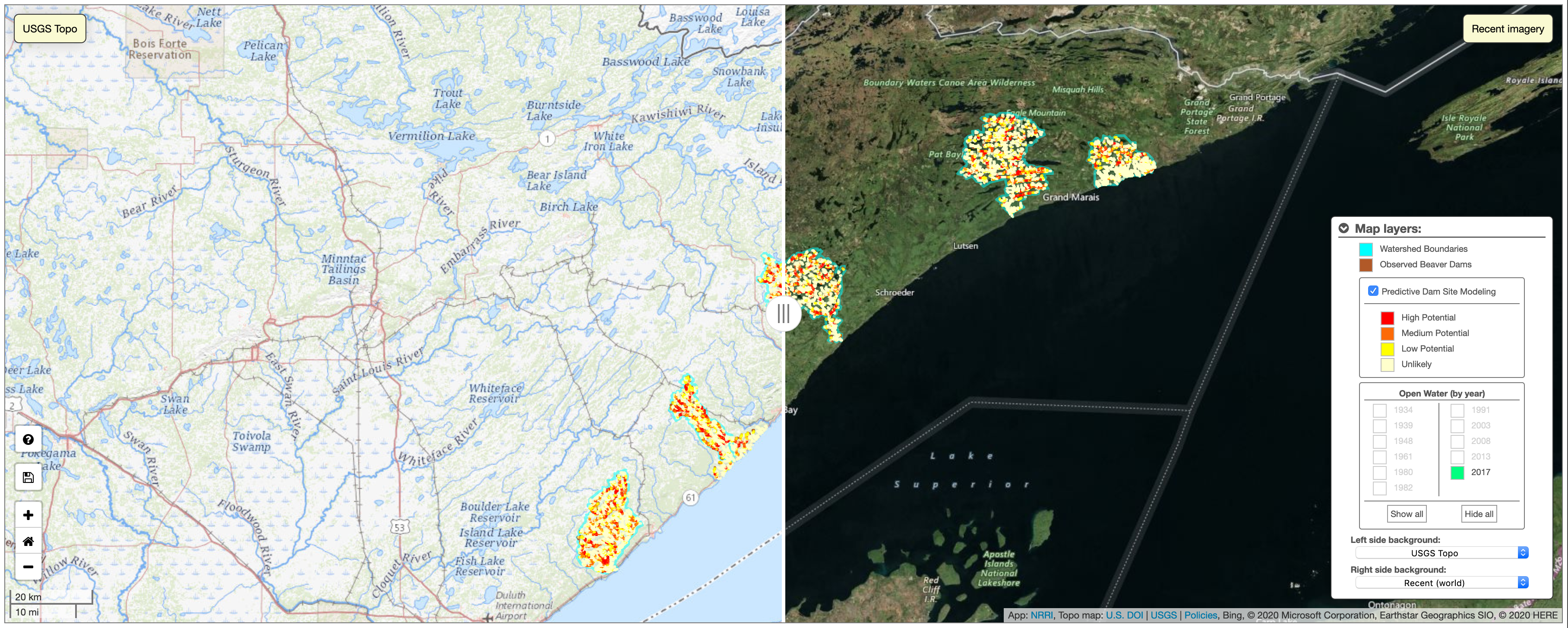
The goal of this project was to develop a model that predicts potential beaver dam locations based on stream channel, watershed and habitat characteristics.
Media Coverage
- – MNAtlas.org wins University of MN Innovation Impact Award – Duluth News Tribune