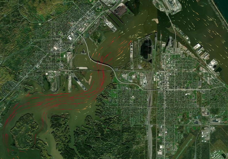
Lake rip currents are powerful, channeled currents of water flowing away from shore. And if a person gets caught in one, they can be deadly. Great Lakes rip currents cause, on average, 10 drowning fatalities a year.
NRRI water researchers have helped inform efforts to better understand the dangerous rip currents along Lake Superior’s south shore, including at Duluth’s Park Point Beach. Buoy observations and rip current models are used by the National Weather Service in Duluth to help inform rip current advisories and warnings of when conditions point to especially dangerous rip currents.
NRRI has long worked with other local stakeholders to deploy and maintain monitoring buoys and sensors to provide Lake Superior observational data. And that information produced rip current computer models developed by Chin Wu, a professor at the University of Wisconsin - Madison.
But what about the St. Louis River estuary? Alive with game fish and shore birds aplenty, it attracts folks in boats, canoes and kayaks, as well as swimmers along the shore. NRRI is involved in a new project to more broadly apply Wu’s water current model to the estuary to identify potential and imminent drowning hotspots.
This effort is funded by the Minnesota Department of Natural Resources Minnesota’s Lake Superior Coastal Program and the Wisconsin Coastal Management Program.
Hotspots and Rips
How do river currents move at and below the surface of this 12,000-acre area of freshwater? How do tributary inflows to the estuary create dynamic mixing patterns, and potentially localized dangerous currents? And what happens when water flow is especially heavy, like during spring snowmelt? Or how does it flow under the ice in the winter?

“We know the estuary is very dynamic and has influences from the St. Louis River and other tributaries, as well as from Lake Superior’s seiche,” said Chris Filstrup, NRRI limnologist and one of the leaders of this effort, “but we don’t know where the drowning risks are and how they change depending on flow conditions.”
The researchers are working with search and rescue personnel in Minnesota and Wisconsin who have responded to incidents in the estuary to provide them with information about when and where the drowning hotspots are.
First, they will look through historical drowning incidents data – old newspaper articles, community archives, and any rescue crew records. Beyond the incident itself, they hope to glean information about what the conditions were like at the time.
Once they’ve established the historical record, the next step is to understand the currents to prevent future drownings.
“With this year’s rapid snowmelt, there’s a lot of water moving through the estuary, with high flow from the St. Louis River and other streams,” said Filstrup. “That could create some pretty strong currents, and combined with the really cold water, could create a dangerous situation for people on the water.”
Volunteer Science Support
The effort relies on two groups of volunteers to gather and validate information for the project.
UMD’s Recreation Sports Outdoors Program will host kayak tours outfitted with a GPS and temperature sensor towed behind. This will collect data to help validate the temperature portion of the model.
A second citizen science volunteer group will tap recreational paddlers to record the height of the river and use sensors to record surface observations of temperature, conductivity, and total dissolved solids through the summer and fall.
Preventing drownings hasn’t been a strategic mission of NRRI, but having the expertise to contribute data collection and real-time measurements of water conditions to this important project is fulfilling. But as a scientist, Filstrup is also thinking about applications of the circulation model to support NRRI’s mission.
“We are working on several projects in the estuary this summer, looking at different aspects of water quality,” Filstrup said. “Once we’ve developed the circulation model, we can apply it to how water movement affects nutrient cycling and harmful algal blooms.”
Learn more about volunteering for this project by contacting Tiffany Sprague at tsprague@d.umn.edu.
